Catalog Archive
Auction 113, Lot 217

"Map Showing the Routes travelled by the Command of Majr E. Steen, U. S. Drags., against the Snake Indians in 1860", U.S. War Department

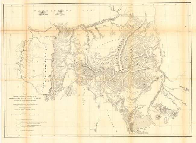
Subject: Northwestern United States

Period: 1860 (published)

Publication: Sen Ex Doc No. 1, 37th Cong., 2nd Sess.

Color: Black & White

Size:
33.5 x 24 inches
85.1 x 61 cm
Download High Resolution Image
(or just click on image to launch the Zoom viewer)

Extensive and detailed map of the area east of the Deschutes River, extending to the Snake River, and from the desert southeast of Lake Harney to the Columbia River. The map represents a decisive military action against the Shoshones, who were defeated during this campaign. Details many exploration routes, emigrant and Indian trails, camps, battlegrounds, and forts including Boise, Walla Walla, Dalles, Cascade, and Vancouver. Portland appears as a rather small community. Clearly shows the Oregon Trail (labeled the Immigrant Road) with springs along the way. Several large regions are marked as Unexplored. Lithographed map (by Julius Bien & Co.) on a scale of about 12 miles to the inch.

References: Wheat (TMW) #1016.

Condition: B

Issued folding, now backed with archival tissue. A little very light toning along some folds, else very good.

Estimate: $200 - $250

Sold for: $300

Closed on 12/7/2005

Archived