Catalog Archive
Auction 113, Lot 198

"Map of the Cessions and Reservations of the Upper and Lower Sioux Indians", U.S. Bureau of Indian Affairs

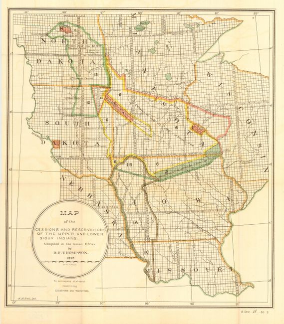
Subject: Central United States

Period: 1897 (dated)

Publication: Sen Doc 68, 55th Cong., 2nd Sess.

Color: Printed Color

Size:
16.8 x 18.8 inches
42.7 x 47.8 cm
Download High Resolution Image
(or just click on image to launch the Zoom viewer)

An uncommon map that was compiled in the Indian Office by R. F. Thompson. The map encompasses portions of North Dakota, South Dakota, Minnesota, Nebraska, Missouri and Wisconsin and all of Iowa. Coloring and notes give history of cessions, tribal boundaries, reservations, and more. Drawn by A.H. Bell to accompany the statement concerning Sissetons and Wahpetons known today as the Sisseton-Wahpeton Sioux Tribe. The people of this tribe are descendants of the Sisseton and Wahpeton Dakota bands. They are believed to be two of the original Seven Council Fires or the "Oceti-Sakowin."

References:

Condition: A

Good color and impression. Folding, as issued with one small fold intersection split. A couple areas of light toning or color offsetting, still very good.

Estimate: $100 - $140

Sold for: $110

Closed on 12/7/2005

Archived