Catalog Archive
Auction 113, Lot 181

"Nova Terrae-Mariae Tabula", Ogilby, John

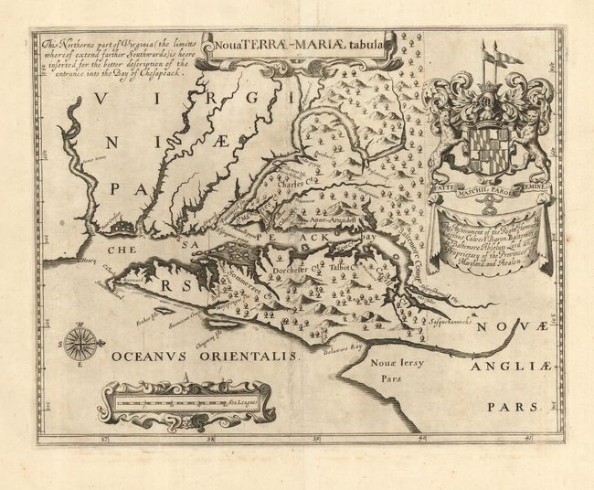
Subject: Colonial Mid Atlantic

Period: 1671 (published)

Publication: An Accurate Description and Complete History of America

Color: Black & White

Size:
14.8 x 11.5 inches
37.6 x 29.2 cm
Download High Resolution Image
(or just click on image to launch the Zoom viewer)

This is Ogilby's edition of the earliest obtainable printed map of Maryland. It is a copy of the very rare Lord Baltimore map, originally published in 1635 to promote the new colony. It is based largely on John Smith's map of Virginia (1612) and possibly supplemented by Cyprian Thorowgood's explorations. The map provides more up-to-date nomenclature and improves greatly on the delineation of the Potomac River and the Atlantic coastline including Delaware Bay. The boundaries of the Calvert land grant are shown with dotted lines. When first issued, the northern boundary along the 40th parallel was depicted too far south. This resulted in later border disputes with Pennsylvania. Although corrected here on Ogilby's map, the dispute was not settled until the Mason-Dixon Line was drawn in the 1760's. Ogilby's version is also noteworthy for being the first to describe the names of the counties of Maryland. In fact, Ogilby may have been privy to information directly from Cecil Calvert, Lord Baltimore, because Cecil County (Caecill on the map) was not officially created until 1674. Three tiny settlements, St. Maries, Harington, and Calverton, are shown along with several Indian villages. The map is embellished with the large coat of arms of Lord Baltimore, two strapwork cartouches and a nice compass rose.

References: Burden #240.

Condition: B

Fine impression and wide, original margins. Scattered toning or surface soiling. Amateur repairs along centerfold that would benefit from professional attention. Still a very sound and presentable example of this most desirable map.

Estimate: $5,500 - $6,500

Sold for: $4,000

Closed on 12/7/2005

Archived