Catalog Archive
Auction 113, Lot 153

"No. 5 Map of the United States Engraved to Illustrate Mitchell's School and Family Geography", Mitchell, Samuel Augustus

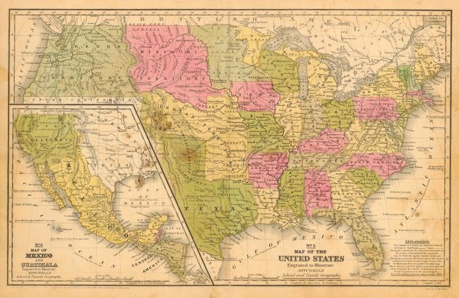
Subject: United States

Period: 1845 (circa)

Publication: Mitchell's School and Family Geography

Color: Hand Color

Size:
16.5 x 10.3 inches
41.9 x 26.2 cm
Download High Resolution Image
(or just click on image to launch the Zoom viewer)

A map with terrific state and territorial borders. Features the Independent Republic of Texas with the long stovepipe border extending to the 42nd parallel. Oregon Territory extends from the 42nd parallel to British America and east to Missouri Territory at the Continental Divide. A huge Indian Territory stretches from Texas to Missouri Territory along the North Fork of the Platte River. With large inset map, " No. 6 Map of Mexico and Guatimala " that shows Upper California with a different color than Mexico and no indication of gold. The map appears to carry the copyright date of 1836 but the line of text below the border is very faint.

References:

Condition: B

Good color and impression. Scattered foxing and some areas of staining or mold.

Estimate: $150 - $200

Sold for: $210

Closed on 12/7/2005

Archived