Catalog Archive
Auction 113, Lot 105

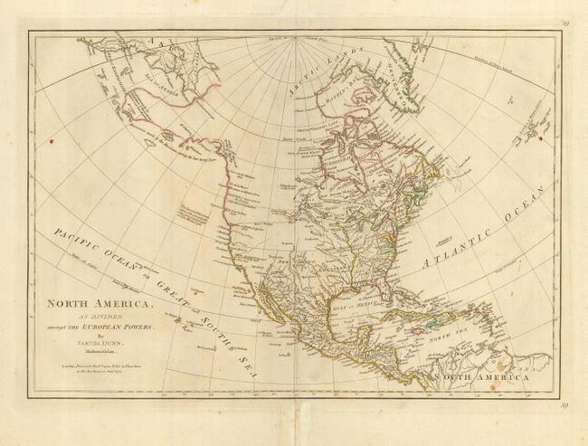
"North America, as Divided amongst the European Powers", Dunn, Samuel

Subject: North America

Period: 1776 (published)

Publication: Dunn's New Atlas or Mundane System of Geography

Color: Hand Color

Size:
17.5 x 12 inches
44.5 x 30.5 cm
Download High Resolution Image
(or just click on image to launch the Zoom viewer)

This copper engraved map details North America at the start of the Revolutionary War. This is the second edition that adds the note regarding Spanish explorations up the west coast to Lat. 45° as of 1776, and notes various explorers along the West Coast, including Sr. Francis Drake, Juan De La Fuca, Tchirikow, and the "Land which is supposed to be the Fousang of the Chinese Geographers." Alaska extends as a vague outline nearly to Kamchatka with Mt. St. John near its westernmost extent. The area is labeled as "Discoveries made by the Russians, during the last twenty Years." The mythical River of the West is a long dotted line that connects Aguilar's entrance north of San Francisco Bay with a river system below Lake Winnipeg. With several Indian tribes located and the names of major cities. Texas is here called New Leon. Light outline coloring indicates the colonial holdings throughout the continent. Published by Robert Sayer.

References:

Condition: B

Fine impression with light hand coloring in outline. On a full sheet of thick hand laid paper with wide margins. Large fleur-de-lys watermark with GR below. A little scattered foxing or toning.

Estimate: $600 - $800

Sold for: $450

Closed on 12/7/2005

Archived