Catalog Archive
Auction 112, Lot 703

"A New and Accurate Map of Nubia & Abissinia together with all the Kingdoms Tributary Thereto, and bordering upon them. Laid down from the latest & best Authorities and regulated by Astronl. Observations", Bowen, Emanuel

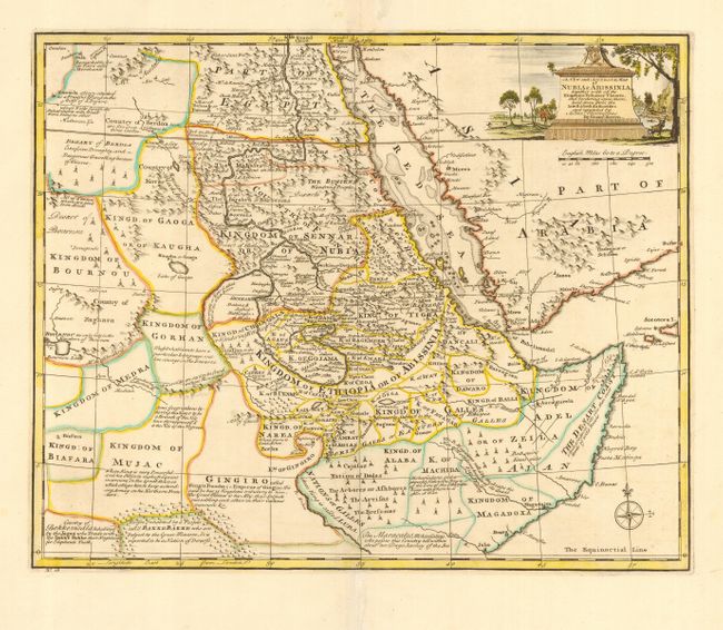
Subject: Eastern Africa

Period: 1747 (published)

Publication: A Complete System of Geography…

Color: Hand Color

Size:
17 x 14 inches
43.2 x 35.6 cm
Download High Resolution Image
(or just click on image to launch the Zoom viewer)

Finely engraved and informative map covering eastern Africa, the Red Sea and part of Arabia. Names many kingdoms in the region of present-day Egypt, Sudan, Somalia, Ethiopia, and Eritrea. Filled with place names, trails, and extensive notations describing various tribes and traveling conditions (Desart of Berdoa - Excessive Droughty, and dangerous travelling because of thieves). A handsome map that includes a pictorial cartouche and a compass rose.

References:

Condition: A

Repairs on fold separations in blank margins.

Estimate: $200 - $250

Sold for: $150

Closed on 9/28/2005

Archived