Catalog Archive
Auction 112, Lot 667

"An Accurate Map of the East Indies, from the latest Improvements and Regulated by Astronomical Observations", Middleton, Charles T.

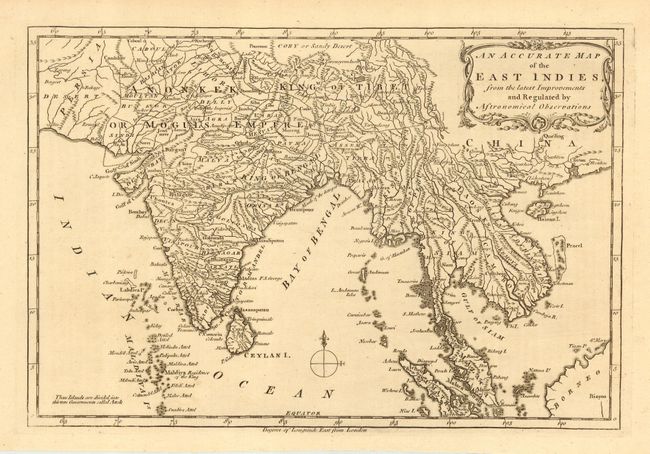
Subject: Southeast Asia

Period: 1779 (published)

Publication: Complete System of Geography

Color: Black & White

Size:
11.5 x 7.8 inches
29.2 x 19.8 cm
Download High Resolution Image
(or just click on image to launch the Zoom viewer)

Strongly engraved map with rococo-style title cartouche and compass rose. Extends from Persia to Indo-China and south to include most of Sumatra and the corner of Borneo. Good depiction of the Maldives, Ceylon, Siam, Laos, Cambodia, the Andaman's, Achem (Banda Aceh), and the Malaca (Malaysian) Peninsula. Locates the King of Bengal, King of Tibet, and Anonkek or the Monguls Empire. At the top of the map is the Goby or Sandy Desert north of Tibet.

References:

Condition: A

Fine impression on hand laid paper with original margins.

Estimate: $90 - $120

Sold for: $65

Closed on 9/28/2005

Archived