Catalog Archive
Auction 112, Lot 436

"Calais, Ville Forte de Picardie…", Fer, Nicolas de
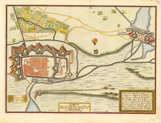
Subject: France

Period: 1695 (circa)

Publication: Les Forces de l'Europe

Color: Hand Color

Size:
10.8 x 7.8 inches
27.4 x 19.8 cm
Download High Resolution Image
(or just click on image to launch the Zoom viewer)

Fine bird's-eye plan of the fortifications at Calais and Fort de Nieulet engraved by Herman van Loon. Nicolas de Fer held the title of Geographer at Louis XIV's court. He was one of the most prolific publishers of plans of European cities in the late seventeenth century.

References: Pollak #21.

Condition: A

Manuscript page number in upper right margin.

Estimate: $110 - $150

Sold for: $80

Closed on 9/28/2005

Archived