Catalog Archive
Auction 112, Lot 364

"Mappa Aestivarum Insularum, alias Barmudas Dictarum…", Blaeu, Willem
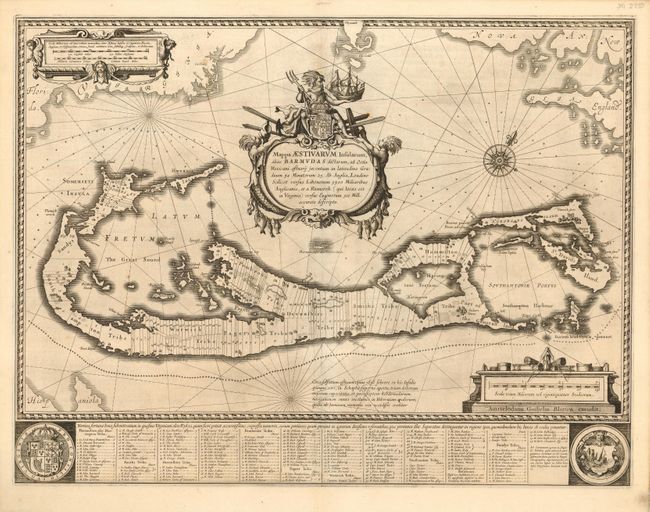
Subject: Bermuda

Period: 1640 (circa)

Publication:

Color: Black & White

Size:
20.8 x 15.8 inches
52.8 x 40.1 cm
Download High Resolution Image
(or just click on image to launch the Zoom viewer)

This magnificent map is based on the famous survey by John Norwood of the Bermuda Company in 1618. The map shows the division of the island into the original eight tribes and shows the various landowners, with their names in a table below the map. The beautiful title cartouche features Neptune astride the Royal Arms. Further adorned with scale cartouches, coats of arms and compass rose with a fleur-de-lis. The map uses a unique devise to show Bermuda's correct proportion and position in the North Atlantic by superimposing this map over a smaller scale map of the Atlantic with the coastlines of Britain, North America and Hispaniola with a tiny island of Bermuda appearing just beneath the title cartouche. Dutch text on verso.

References:

Condition: A

Expertly and seamlessly remargined using the leaf cast method with minor repairs on centerfold.

Estimate: $2,000 - $2,300

Sold for: $1,500

Closed on 9/28/2005

Archived