Catalog Archive
Auction 112, Lot 330

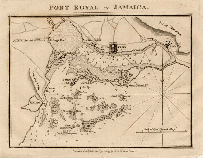
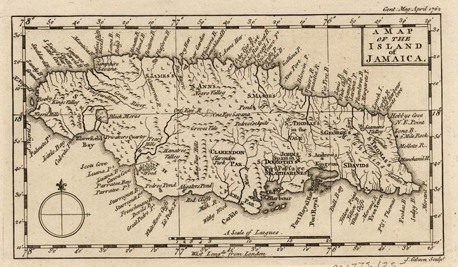
"[Lot of 2] Port Royal in Jamaica [and] A Map of the Island of Jamaica", Various

Subject: Jamaica

Period: 1762-1809 (published)

Publication:

Color: Black & White

Size:
See Description
Download High Resolution Image
(or just click on image to launch the Zoom viewer)

1) This is a fine small chart showing the protected harbor at Port Royal and Kingston. It is from the Naval Chronicle, published by Joyce Gold, Dec. 1809 (6.2x4.5"). The maps in the Naval Chronicle were taken from charts furnished by Arrowsmith in 1805. 2) Charming small map of the island with very good detail. It was engraved by John Gibson and published in the Gentleman's Magazine, April 1762 (7.5x4.1").

References: Jolly NAV-22 & GENT-158.

Condition: A

Couple of tiny edge tears, not affecting maps.

Estimate: $110 - $150

Sold for: $80

Closed on 9/28/2005

Archived