Catalog Archive
Auction 112, Lot 316

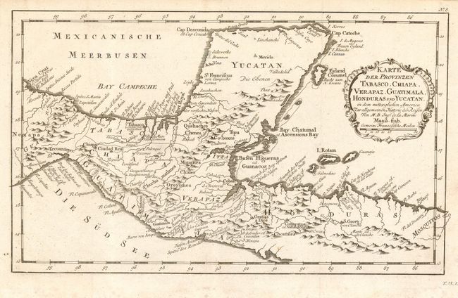
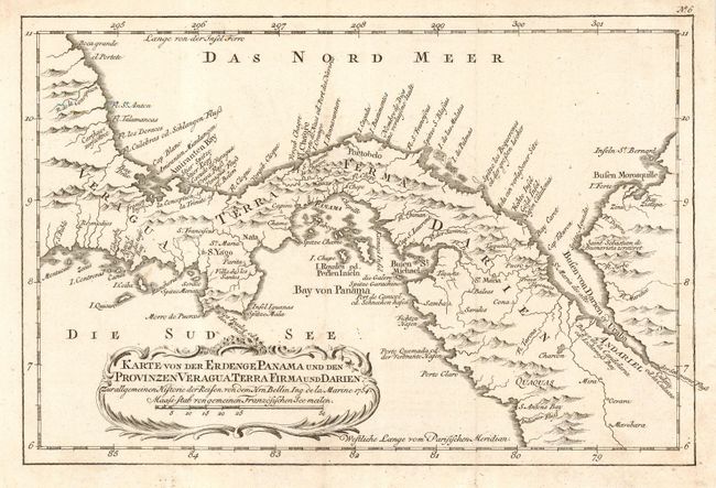
"[Lot of 2] Karte der Provinzen Tabasco, Chiapa, Verapaz, Guatimala, Honduras und Yucatan… [and] Karte von der Erdenge Panama…", Bellin, Jacques Nicolas

Subject: Central America and Mexico

Period: 1760 (circa)

Publication:

Color: Black & White

Size:
13 x 8 inches
33 x 20.3 cm
Download High Resolution Image
(or just click on image to launch the Zoom viewer)

Pair of wonderfully detailed maps from a German edition of Prevost's l'Histoire Generale des Voyages. First (13 x 8") covers the Yucatan Peninsula and northern Central America. Guatemala is limited to a narrow strip along the Pacific coast and El Salvador has yet to be carved out of Honduras. Second (11.5 x 7.8") continues through Central America to the Gulf of Michel and Darien. The maps locate primary harbors, shoals, numerous villages and missions and are decorated with title cartouche.

References:

Condition: A

Faint foxing in blank margins.

Estimate: $170 - $220

Sold for: $130

Closed on 9/28/2005

Archived