Catalog Archive
Auction 112, Lot 303

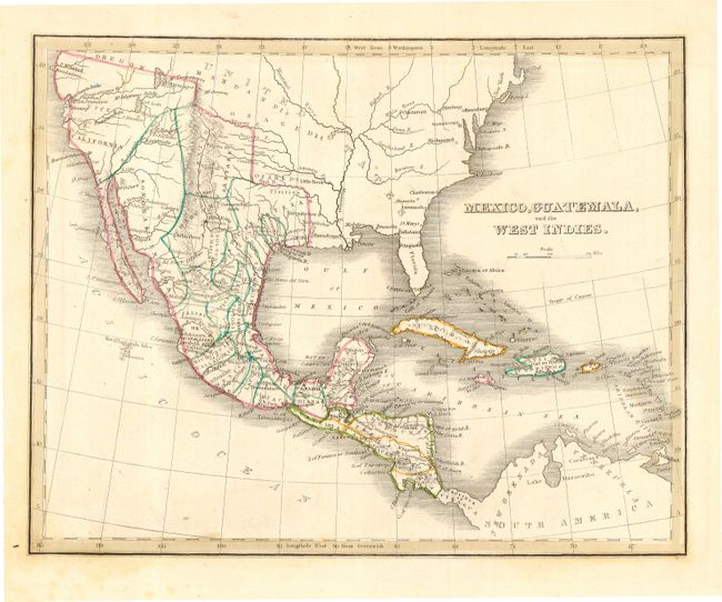
"Mexico, Guatemala, and the West Indies", Bradford, Thomas Gamaliel
Subject: United States, Mexico & Caribbean

Period: 1835 (published)

Publication: Comprehensive Atlas

Color: Hand Color

Size:
9.8 x 7.8 inches
24.9 x 19.8 cm
Download High Resolution Image
(or just click on image to launch the Zoom viewer)

Handsome copper plate map that shows Mexico in control on the entire Southwest, Texas and California with its northern boundary with Oregon Territory. Shows Coahuila & Texas with Austin's Colony outlined separately. The map extends to show all of Central America and the Caribbean. Details include many place names, Indian tribes, etc.

References:

Condition: A

Good impression and original outline color, printed on thick paper with wide margins. A little light foxing in blank margins.

Estimate: $120 - $220

Sold for: $80

Closed on 9/28/2005

Archived