Catalog Archive
Auction 112, Lot 255

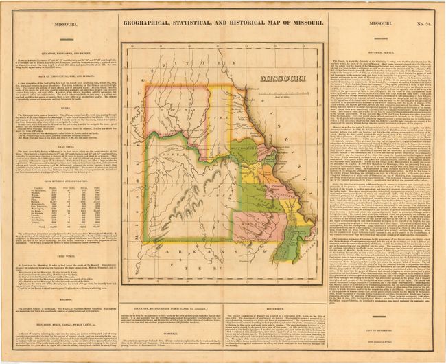
"Geographical, Statistical, and Historical Map of Missouri.", Carey & Lea
Subject: Missouri

Period: 1822 (circa)

Publication: A Complete Historical, Chronological, and Geographical American Atlas

Color: Hand Color

Size:
20.5 x 16.5 inches
52.1 x 41.9 cm
Download High Resolution Image
(or just click on image to launch the Zoom viewer)

First edition and the first published map of Missouri as a state. Locates Jefferson, St. Louis, Franklin, Good Woman's River, etc. The only organized counties are New Madrid, Madison, Washington, Cape Giradeaux, St. Genevieve, Franklin, Jefferson, Montgomery, St. Charles, Lincoln, Pike, and Howard. Virtually no settlement except along the Missouri and Mississippi rivers. The list of governors only contains the first governor: Alexander M'Nair. The map is surrounded by tables of fascinating text including census tables listing the population of whites, free blacks, and slaves. Engraved by Young & Delleker.

References: Phillips (A) #1177.

Condition: B

Very nice original coloring, dark impression and original margins. A little light offsetting or toning, else very good.

Estimate: $350 - $450

Sold for: $250

Closed on 9/28/2005

Archived