Catalog Archive
Auction 112, Lot 198

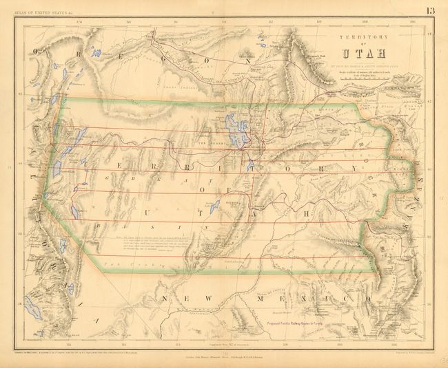
"Territory of Utah", Johnston, W. & A.K.

Subject: United States - Western

Period: 1857 (dated)

Publication: Atlas of The United States of North America…

Color: Hand Color

Size:
16.2 x 13 inches
41.1 x 33 cm
Download High Resolution Image
(or just click on image to launch the Zoom viewer)

A fascinating and seldom seen map of Utah Territory from the rare Atlas of the United States. The map extends from eastern California to beyond the Rocky Mountains to western Kanzas, thus including much of today's Colorado. The territories of Oregon and New Mexico bound Utah to the north and south. It shows forts, topography, early roads, elevations, and much more. Interesting combination of printed and hand coloring; Utah, as well as the lakes, are outlined in hand color while Utah's few counties are delineated with printed color, and block overprinting "Proposed Pacific Railway Routes in Purple." A long note in the map, credited to Fremont's Report, discusses the Great Basin's elevation, topography and its numerous land-locked rivers and lakes. The inhabitants are described as "savage tribes which no traveller has seen or described." Certainly one of the rarest of all maps of Utah Territory. It is derived from the large and rare wall map developed in an unusual collaboration between Prof. Rogers, an American, and the British publishing firm of Johnston. It was drawn by Prof. H.D. Rogers and A. Keith Johnston, and registered in Massachusetts by H.D. Rogers.

References:

Condition: B

Very fine impression and original coloring with full original margins. A trace of centerfold toning and a closed tear in upper right corner, else very good.

Estimate: $700 - $800

Sold for: $700

Closed on 9/28/2005

Archived