Catalog Archive
Auction 112, Lot 170

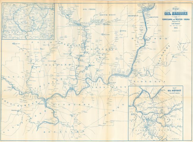
"The Oil Regions of Pennsylvania and Western Virginia", Sweet, S.H.

Subject: Mid-Atlantic - Pennsylvania & West Virginia

Period: 1865 (dated)

Publication:

Color: Printed Color

Size:
30.8 x 22.3 inches
78.2 x 56.6 cm
Download High Resolution Image
(or just click on image to launch the Zoom viewer)

A fabulous and very early map of the oil regions in Pennsylvania and West Virginia with a large inset (8.8 x 8.8") titled "Map of the Oil District of Western Virginia" and an untitled inset (8.5 x 6") showing Crawford, Venango, Mercer and Clarion Counties. This map is very detailed and note locations of oil wells with the main map also giving extensive property ownership information. The map extends from Utica east to Oil Spring in Kingsley County in the east, and from Oil Creek south to Franklin and beyond to Rockland County. Locates Oil City, and numerous individual wells. The town of Cornplanter, named after a Seneca Indian chief, was renamed Oil City and became the major center, along with Titusville, for the area we know today as the Oil Regions. Printed in blue ink.

References:

Condition: A+

Remarkably clean example, folding as issued. One fold intersection with tiny split.

Estimate: $250 - $350

Sold for: $350

Closed on 9/28/2005

Archived