Catalog Archive
Auction 112, Lot 163

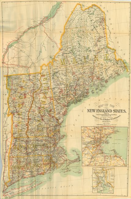
"Map of the New England States Showing State, County & Town Boundaries, Post Offices, Railroad Stations &c.", Walker, George H. & Co.

Subject: New England

Period: 1894 (dated)

Publication:

Color: Printed Color

Size:
26.5 x 41.5 inches
67.3 x 105.4 cm
Download High Resolution Image
(or just click on image to launch the Zoom viewer)

Large and colorful pocket map folding into original paper covers titled Cycling Routes of the New England States. A very finely detailed map with bicycle routes overprinted in red. Extends to include all of Long Island. With two large untitled insets: vicinity of Boston and vicinity of Providence. Early and scarce bicycle route map for which we found no references.

References:

Condition: B

Some fold intersection splits, and some longer splits along one fold, else very good. Front cover has some red stains.

Estimate: $100 - $120

Sold for: $140

Closed on 9/28/2005

Archived