Catalog Archive
Auction 112, Lot 153

"United States and Texas", Johnston, Alexander K.

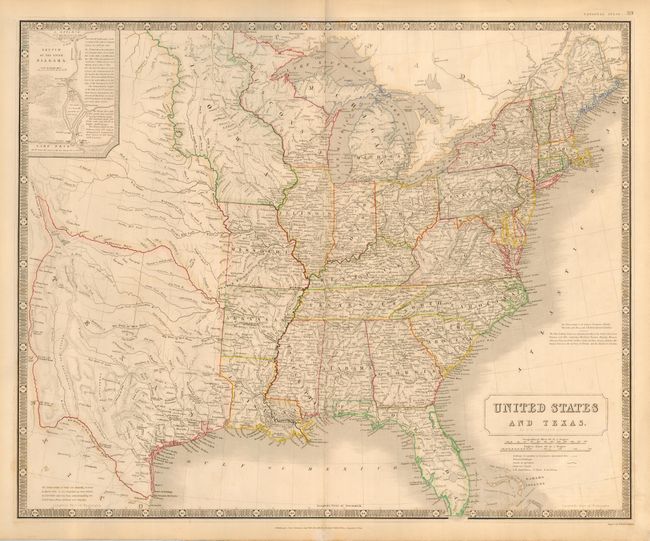
Subject: Eastern United States and Texas

Period: 1843 (circa)

Publication: National Atlas

Color: Hand Color

Size:
24.3 x 20 inches
61.7 x 50.8 cm
Download High Resolution Image
(or just click on image to launch the Zoom viewer)

Handsome map of the eastern United States and the Independent Republic of Texas. Typical of British maps of this period, the map is densely engraved with information. West of the Mississippi is a large, elongated Iowa Territory, reaching from the Missouri River to the Canadian border. Texas is shown with pre-Compromise of 1850 borders, extending from the Rio Grande to the Arkansas, encompassing Santa Fe and even beyond Pike's Peak. A note in the bottom left corner states "The Independence of Texas was formally declared in March 1836. It was recognized by Great Britain in Novr. 1840; and has been acknowledged by the United States, France, Holland and Belgium." In the upper left corner is an inset Sketch of the River Niagara.

References:

Condition: A

Couple of faint spots of foxing, still overall very good.

Estimate: $1,200 - $1,500

Sold for: $1,200

Closed on 9/28/2005

Archived