Catalog Archive
Auction 112, Lot 148

"Charte von den Vereinigten Staaten von Nord-America mit Luisiana", Anon.

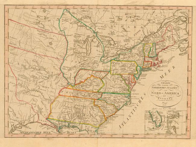
Subject: Eastern United States

Period: 1818 (dated)

Publication:

Color: Hand Color

Size:
16.4 x 11.6 inches
41.7 x 29.5 cm
Download High Resolution Image
(or just click on image to launch the Zoom viewer)

This is a scarce and very interesting map of the United States in the early part of the nineteenth century. There is a huge Indiana Territory taking in the region from Pennsylvania to the Mississippi River. Sandwiched between Indiana Territory and Kentucky is an unnamed region. Georgia extends to the Mississippi and is filled with Indian place names. Louisiana Territory has a division marked at about 41 deg. N but there is no explanation on the boundary. In the southern part of Louisiana is the rarely seen and short-lived region of Neu Orleans occupying most of present-day Louisiana. Southern Florida and the Bahamas are detailed in an inset below the title.

References:

Condition: B

Trimmed to neatline and remargined top and bottom for inclusion in a composite atlas. Small abrasions in bottom border.

Estimate: $350 - $450

Sold for: $250

Closed on 9/28/2005

Archived