Catalog Archive
Auction 111, Lot 82

"North America", Tallis, John

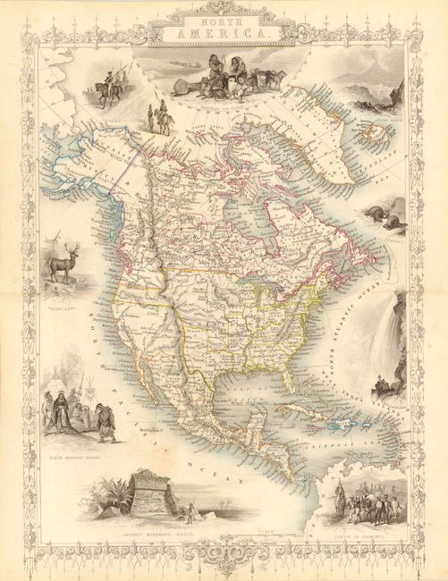
Subject: North America

Period: 1845 (circa)

Publication: Illustrated Atlas and Modern History of the World

Color: Hand Color

Size:
9.5 x 13.7 inches
24.1 x 34.8 cm
Download High Resolution Image
(or just click on image to launch the Zoom viewer)

An early issue of this decorative steel engraved map that features an Independent Texas. It was issued during the time the United States and Britain were arguing over the western U.S./Canadian border. In typical British fashion the border here drops down west of the Continental Divide to the Columbia river. The map is surrounded by steel engraved vignettes by Marchant featuring beavers, elk, North American Indians, Niagara Falls, Mayan ruins, a Convoy of Diamonds, and more. The map is filled with detail including forts and many Indian Tribes. Mexico extends to the northern border of today's California and is simply labeled Mexico. Alaska is Russian America. A rarely seen issue of this map. Surrounded by a delicately engraved and decorative border. Borders and vignettes uncolored, as issued.

References:

Condition: B

Fine, original outline coloring. One small area of toning in the Pacific Ocean, else very good.

Estimate: $250 - $350

Sold for: $220

Closed on 6/8/2005

Archived