Catalog Archive
Auction 111, Lot 388

"The Road from Chester to Cardiff Com. Glamorgan", Ogilby, John
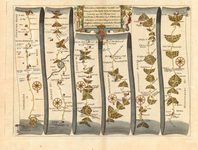
Subject: Wales

Period: 1675 (circa)

Publication: Britannia

Color: Hand Color

Size:
16.7 x 12.5 inches
42.4 x 31.8 cm
Download High Resolution Image
(or just click on image to launch the Zoom viewer)

John Ogilby's 'Britannia' was published between 1675 and 1698. It is a landmark in the mapping of England and Wales. Its unique format constituted the first national road-atlas of any country in Western Europe. It was composed of maps of seventy-three major roads and cross-roads, presented in a continuous strip-form, on a uniform scale of one inch to a mile. Each beautiful map includes wonderful detail of the countryside with each strip containing a large compass rose to indicate changes in direction.

Handsome road map in the pictorial style developed by Ogilby. The map begins at West Chester and proceeds south through Wrexham, Llanfylin, and Newton and ends at Vunneth-Llanbader. The title cartouche includes the royal arms and is flanked by putti.

References:

Condition: A

Wide original margins. Few unobtrusive spots, still overall very good.

Estimate: $325 - $375

Sold for: $240

Closed on 6/8/2005

Archived