Catalog Archive
Auction 111, Lot 180

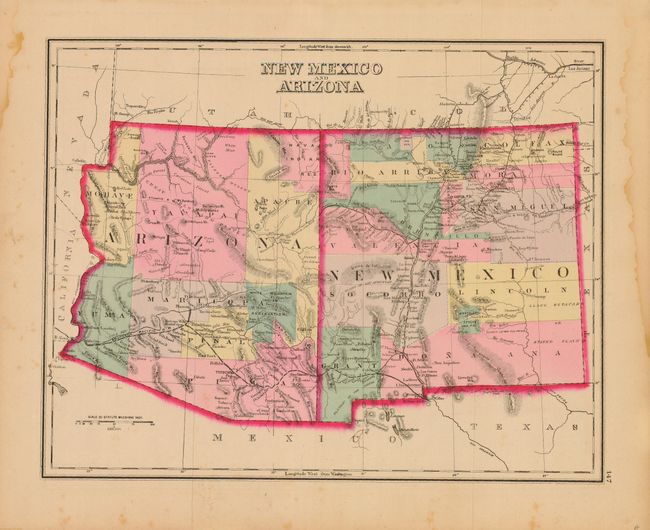
"New Mexico and Arizona", Gray, Ormando Willis & Son

Subject: New Mexico and Arizona

Period: 1881 (published)

Publication: The National Atlas

Color: Hand Color

Size:
14.8 x 11.5 inches
37.6 x 29.2 cm
Download High Resolution Image
(or just click on image to launch the Zoom viewer)

Details the railroads, forts, cities and the topographical and watershed information known at the time. In Arizona there are eight counties with Tucson shown as the capitol. The proposed route of the Atlantic & Pacific Railroad is shown across northern Arizona. The Mescalero Apache, Navajo, and White Mountain Indian Reservations are delineated. In New Mexico there are twelve counties with the route of the Southern Pacific and the Atchison and Topeka railroads illustrated. Nice map of Mexico with an inset of "The Isthmus of Tehuantepec" on verso.

References:

Condition: B

Fine, original pastel coloring and dark impression. A couple of small spots, else very good. Marginal staining well away from image.

Estimate: $90 - $110

Sold for: $65

Closed on 6/8/2005

Archived