Catalog Archive
Auction 111, Lot 159

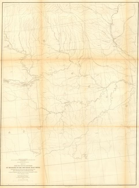
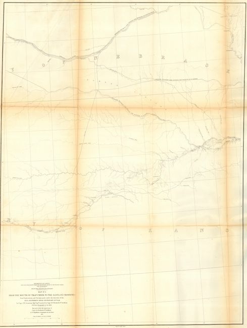
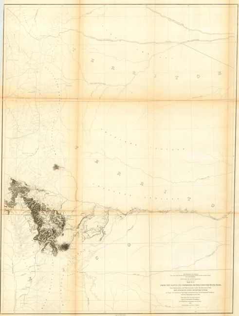
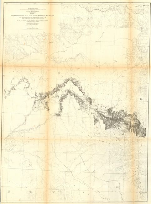
"[Lot of 4] From the Western Boundary of Missouri to the Mouth of Trap Creek [and] From the Mouth of Trap Creek to the Santa Fe Crossing [and] From the Santa Fe Crossing to the Coo-che-to-pa Pass [and] From the Coo-che-to-pa Pass to the Wahsatch Mountains", Gunnison, John William [Capt.]

Subject: United States - Western

Period: 1855 (dated)

Publication: U.S. Pacific Railroad Surveys

Color: Black & White

Size:
See Description
Download High Resolution Image
(or just click on image to launch the Zoom viewer)

A matched set of four maps that are seldom seen or offered together. Map No. 1 details the proposed routes across the territories of Missouri and part of Kansas. Three proposed railroad routes are shown and named. The North Missouri R.R. heads north from above Washington on the Missouri River. The Pacific R.R. follows the Missouri R. to Jefferson City then on to Independence where it reconnects with the Missouri and then moves upstream along the Kansas River. The South West Branch heads southwest to Springfield and beyond (23.5" x 31").

Map No. 2 details the proposed routes across the territories of Kansas and Nebraska. [1] Leaving the Missouri R. at Kansas and following the Pawnee Republican Fork, [2] Leaving the Missouri R. at St. Joseph westward to the Republican River, [3] Leaving the Missouri R. at Council Bluffs westward along the Platte River (23" x 31.5").

The third map in this series shows the proposed routes across parts of New Mexico and today's Colorado. Details along the route surveyed include watershed and topographical via fine hachure. Locates North, Middle and South Parks, Cheyenne Pass, Saint Vrain's Fort, Pikes Peak and more (23.7" x 31.5").

Gunnison's final and most detailed map of the series that Wheat illustrated in full. Minimal detail in the north and south, the map provides much detail along the route through western Colorado and Utah. Locates Fort Uintah, Brown's Hole, the Old Spanish Trail, and Bridger's Pass. An interesting and important map of the region that would eventually be followed by the Denver and Rio Grande Railroad. Capt. Gunnison was killed by hostile Indians at the western portion of this exploration, but Capt. E.G. Beckwith recovered his survey notes and completed the map (23.2" x 31.5").

References: Wheat (TMW) #843, 844, 845 and 846.

Condition: B

Some light toning along centerfolds and a few tiny fold intersection splits, else very good.

Estimate: $450 - $550

Unsold

Closed on 6/8/2005

Archived