Catalog Archive
Auction 111, Lot 146

"Carta Geografica della Florida nell' America Settentrionale", Albrizzi, Girolamo

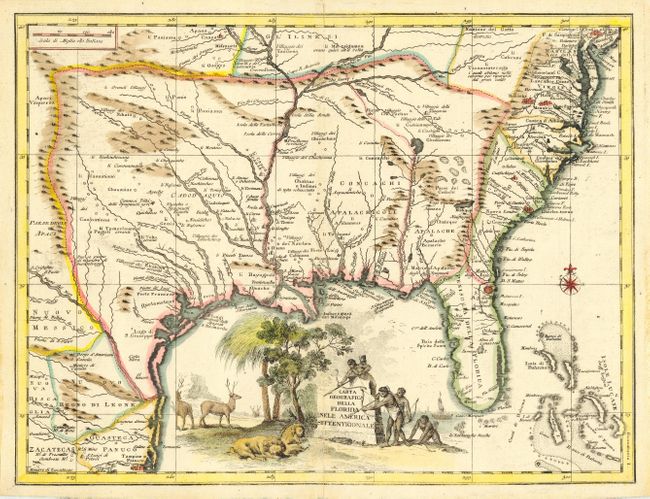
Subject: Colonial Southeast

Period: 1740 (circa)

Publication: Atlante Novissimo

Color: Hand Color

Size:
17 x 12.8 inches
43.2 x 32.5 cm
Download High Resolution Image
(or just click on image to launch the Zoom viewer)

Finely engraved copper plate map that shows the southeast part of North America based on Delisle. Shows the region from Filadelfia south to the Bahamas, and the coast of the Gulf of Mexico to Tampico. Shows the same area as Ortelius' 1584 map and several earlier maps; but most of the earlier names have been replaced with later names for rivers, towns and villages, and political divisions. The British colonies are confined east of the Apalache. Georgia is named in part of Carolina, indicating a knowledge of contemporary political realities. The large pictorial title cartouche features natives aiming arrows at resting lions with elk in the background. Compass rose.

References: Cumming 277 (attributing Delisle).

Condition: A

Professional repair of small split in lower centerfold, very slight centerfold toning, still very good.

Estimate: $1,000 - $1,400

Sold for: $850

Closed on 6/8/2005

Archived