Catalog Archive
Auction 111, Lot 12
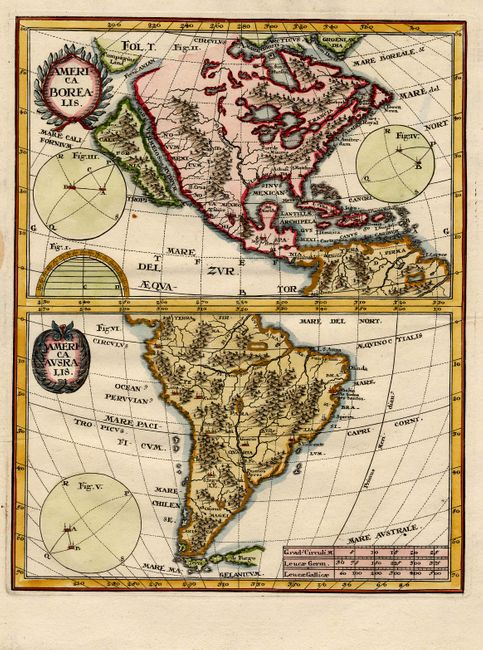
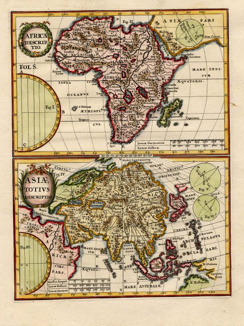
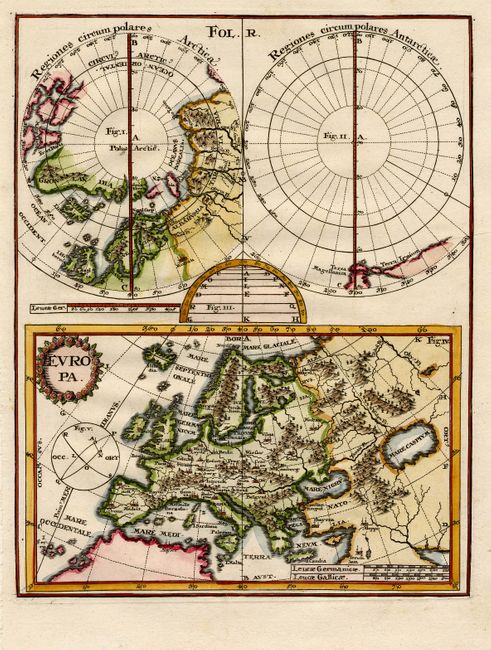
"[Lot of 3 - World & Continents]", Scherer, Heinrich
1 of 3
Subject: World & Continents
Period: 1710 (published)
Publication: Atlas Novus
Color: Hand Color
Size:
7 x 9.1 inches
17.8 x 23.1 cm
Download High Resolution Image
(or just click on image to launch the Zoom viewer)
(or just click on image to launch the Zoom viewer)