Catalog Archive
Auction 111, Lot 125

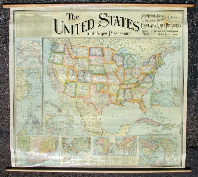
"The United States and its new Possessions - Puerto Rico, Cuba, Hawaii, Philippine Islands and Alaska with General Maps of Europe, Asia, Africa and Pan-America", National Publishing Co.

Subject: United States

Period: 1900 (dated)

Publication:

Color: Printed Color

Size:
39 x 36 inches
99.1 x 91.4 cm
Download High Resolution Image
(or just click on image to launch the Zoom viewer)

This interesting and very detailed wall map was produced for the American classroom at the turn of the 20th century. The map emphasizes the new possessions of the United States during the Age of Imperialism following the Spanish-American War of 1898. This was a time when the United States was emerging as an imperialist world power in an attempt to protect its trade markets overseas. The map presents the United States with vividly colored states surrounded by eleven inset maps: Alaska, Philippine Islands, Hawaiian Islands, Pacific Ocean and Oceanica, South Africa, Europe, Africa, Asia, North America, South America, and the Atlantic Ocean. Includes three tables: Travel Distances between Important Centers in the United States, Principal Divisions of the World with Area and Populations, and United States - States and Territories. Linen backed with original varnished surface and wooden rollers.

References:

Condition: A

Remarkably good condition with only a couple of faint stains. Bit of creasing and a repaired tear at upper center. Both original rods have been expertly reattached.

Estimate: $350 - $450

Sold for: $550

Closed on 6/8/2005

Archived