Catalog Archive
Auction 111, Lot 122

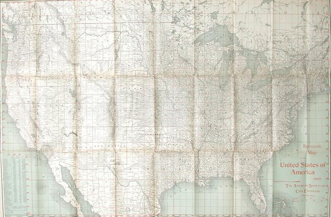
"Reference Map of the United States of America 1893 Presented by the American Society of Civil Engineers", Rand McNally & Co.

Subject: United States

Period: 1893 (dated)

Publication:

Color: Printed Color

Size:
30.5 x 20.5 inches
77.5 x 52.1 cm
Download High Resolution Image
(or just click on image to launch the Zoom viewer)

Very detailed and finely printed map with red over-printed latitude and longitude lines forming a grid. The map folds into cloth covers with title: "Reference Map of the United States Compliments of the American Society of Civil Engineers 1893." Hardbound in blue cloth with gilt titling (4.5" x 7.5"). Text (55 pp.) consists mostly of a list of major projects and manufactures, all keyed to the map with latitude and longitude indicated for each. On the title page is the disclaimer "This society is not responsible as a body for the facts and opinions advanced in any of its publications." These people build our bridges and skyscrapers and they aren't responsible for the facts they publish - amazing! A most unusual and scarce issue in fine condition.

References:

Condition: A+

Binding, contents and map fine. A couple fold intersection splits as normally found, still fine.

Estimate: $120 - $180

Sold for: $170

Closed on 6/8/2005

Archived