Catalog Archive
Auction 110, Lot 671

"Nieuwe Kaart van de Kaap der Goede Hoope en der na by gelegen Landen", Tirion, Isaac

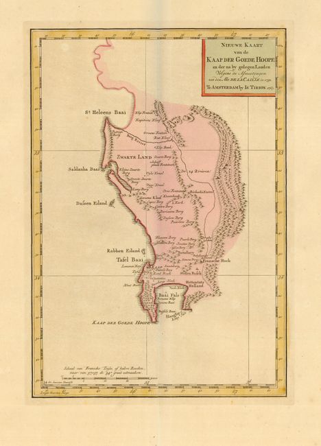
Subject: Africa - Southern

Period: 1763 (dated)

Publication: Nieuwe en Beknopte Hand Atlas

Color: Hand Color

Size:
8.5 x 12.2 inches
21.6 x 31 cm
Download High Resolution Image
(or just click on image to launch the Zoom viewer)

This detailed map of the vicinity of the Cape of Good Hope was based on Nicolas Louis de la Caille's important map. De la Caille's scientific expedition to South Africa was a landmark in the history of science. His observations established the parallax of the sun and moon with Mars adjacent, and embarked upon the measurement of the arc of meridian - the southern point of which was the observatory in Cape Town, and the northern point Klipfontein. The map covers the region between Cape Point and St. Helena Bay. It is very detailed with numerous place names including the French settlement at Fransche Hoek.

References: Norwich #221.

Condition: A+

Original color and extremely wide margins. Slight color offsetting in border, still fine.

Estimate: $150 - $200

Sold for: $160

Closed on 3/2/2005

Archived