Catalog Archive
Auction 110, Lot 62

"Le table des neufues Iesquelles on appelle isles d'Occident & d'Indie pour diuers regard", Munster, Sebastian

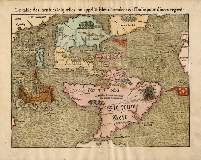
Subject: Western Hemisphere

Period: 1569 (circa)

Publication: Cosmographia

Color: Hand Color

Size:
13.5 x 10 inches
34.3 x 25.4 cm
Download High Resolution Image
(or just click on image to launch the Zoom viewer)

This is one of the most important 16th century maps of the New World, credited with popularizing the name America. North America is very oddly shaped with no California and Zipangri (Japan) shown only a short distance off the western coast. In the east, the land is nearly bisected by a body of water, known as the Sea of Verrazzano. The Yucatan is still shown as an island and the lake at Temistitan is connected to the Gulf of Mexico. South America has a large bulge in the northwest, the Amazon River is very short and cannibals are noted as inhabiting the continent. The map is decorated with Magellan's surviving ship Victoria appearing in the Pacific. The flags of Spain and Portugal depict their respective spheres of influence in the New World.

References: cf. Burden #12, state 11; Kershaw #11.

Condition: A

Professional repair of a couple of small worm and binding holes. Slight show-through of text on verso.

Estimate: $4,000 - $5,000

Sold for: $3,500

Closed on 3/2/2005

Archived