Catalog Archive
Auction 110, Lot 351

"A New Map of the Kingdome of England and Principality of Wales…", Overton, Henry

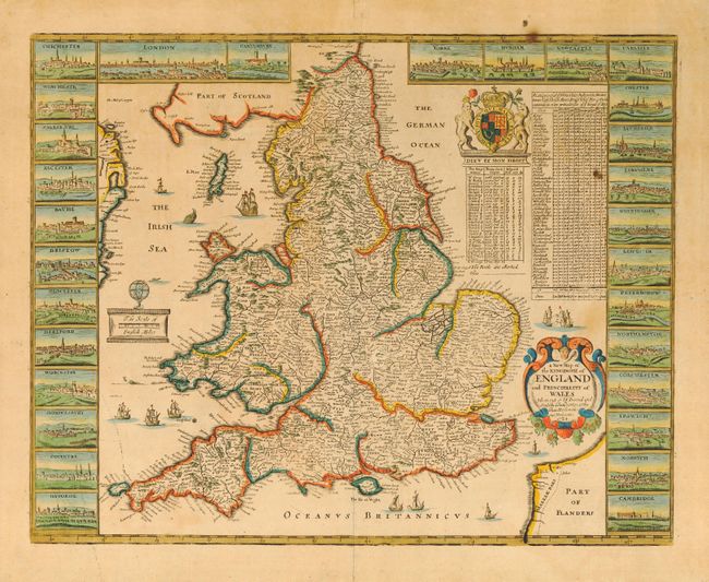
Subject: England & Wales

Period: 1724 (dated)

Publication:

Color: Hand Color

Size:
19.7 x 15.5 inches
50 x 39.4 cm
Download High Resolution Image
(or just click on image to launch the Zoom viewer)

This is an uncommon and very attractive map of England and Wales with panels featuring 29 city views. The British royal coast of arms surmounts a table showing the reigns of the British monarchs in the upper right quadrant. Further embellished with title and distance scale cartouches, ships and sea monsters.

References:

Condition: C

Toned with a couple of spots. Laid down on cardboard from a previous framing, the age of which indicates it can be removed by a conservator. Paper appears to be sound and the map is attractive as is.

Estimate: $300 - $400

Sold for: $4,000

Closed on 3/2/2005

Archived