Catalog Archive
Auction 110, Lot 348

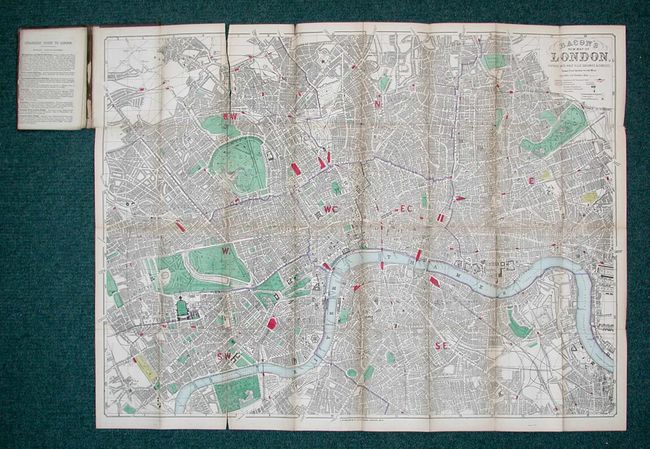
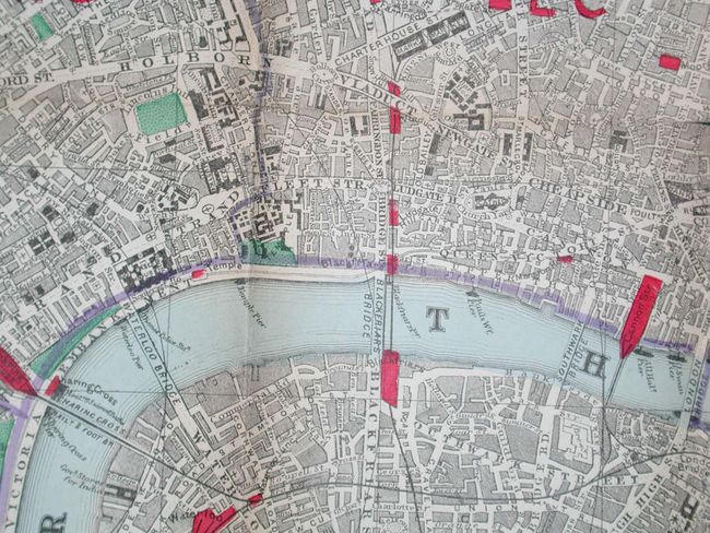
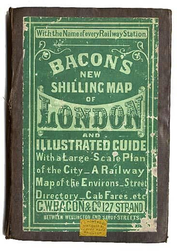
"Bacon's New Shilling Map of London and Illustrated Guide With a Large-Scale Plan of the City - A Railway Map of the Environs - Street Directory - Cab Fares Etc.", Bacon, G. W. & Company

Subject: England, London

Period: 1874 (dated)

Publication:

Color: Hand Color

Size:
32.2 x 24 inches
81.8 x 61 cm
Download High Resolution Image
(or just click on image to launch the Zoom viewer)

Detailed folding map covering from Hampstead to Hackney Downs in the north, and from Walham Green to Greenwich Beach in the south. Color depicts parks, rail stations, and cemeteries. Includes a smaller (15.5 x 5.6") uncolored map, "Large Scale Map of Central London," on a scale of 9" to the mile, that provides excellent detail right down to the names of buildings. 45 pp. Stranger's Guide and index. Folds into original cloth covered boards with paper label.

References:

Condition: C

Map is overall good with light toning and several splits on folds, without loss and all easy to repair. Paper label and cover slightly rubbed with small split on spine.

Estimate: $250 - $300

Sold for: $180

Closed on 3/2/2005

Archived