Catalog Archive
Auction 110, Lot 208

"Map of New York and the Adjacent Cities", Colton, Joseph Hutchins
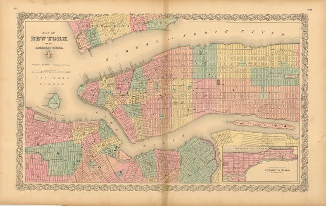
Subject: New York

Period: 1855 (dated)

Publication: Atlas of the World

Color: Hand Color

Size:
26 x 16 inches
66 x 40.6 cm
Download High Resolution Image
(or just click on image to launch the Zoom viewer)

Great double-page map of Manhattan up to 87th Street including part of Brooklyn and Jersey City. Fine detail of streets, squares, the Battery, and parks including the proposed Central Park. The pre-Central Park area still shows the existing city streets, but with light lettering "Proposed Central Park". Out of 33 plans submitted anonymously, the city commissioners chose the "Greensward Plan" by Frederick Law Olmsted. Olmsted's plan was significantly influenced by his study of England's Birkenhead Park, which opened in 1847 and was the first publicly funded park in Britain. Inset extends from 86th Street up to King's Bridge on a reduced scale. Filled with fascinating detail. A handsome sheet with Colton's decorative border. This edition was published in 1856.

References:

Condition: B

Light toning on centerfold with separation and short tear at bottom, repaired on verso with acid-free tape.

Estimate: $140 - $180

Sold for: $100

Closed on 3/2/2005

Archived