Catalog Archive
Auction 110, Lot 178

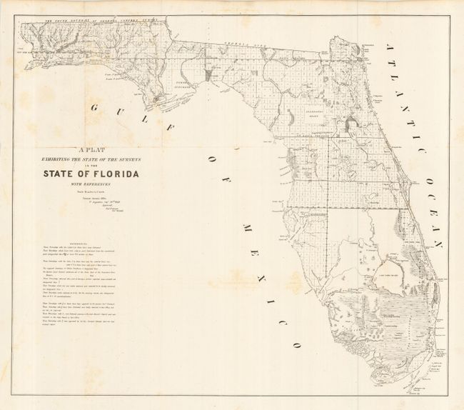
"A Plat Exhibiting the State of the Surveys in the State of Florida", U.S. State Surveys
Subject: Florida

Period: 1849 (dated)

Publication:

Color: Black & White

Size:
25 x 22.4 inches
63.5 x 56.9 cm
Download High Resolution Image
(or just click on image to launch the Zoom viewer)

An interesting and detailed early lithographed map representing the progress of surveying in the state. Clearly shows the Everglades, Big Cypress, the Northern Keys, Arredondo Grant, Forbes Purchase, Lake O-Kee-Cho-Bee, and numerous forts. Extends to include Cayo Largo and the keys above. The transition between the Everglades and the gulf is indistinct along the southwest coast. Issued from St. Augustine by R.A. Putnam, Surveyor General. This chart carries the same title as other 1849 issues we've seen, but this example has the references and title in a configuration we've not seen before.

References:

Condition: B

Issued folding, now pressed and mounted on archival tissue. A little light toning in blank seas, else very good.

Estimate: $200 - $240

Sold for: $120

Closed on 3/2/2005

Archived