Catalog Archive
Auction 110, Lot 16

"Novissima Totius Terrarum Orbis Tabula", Visscher, Nicolas
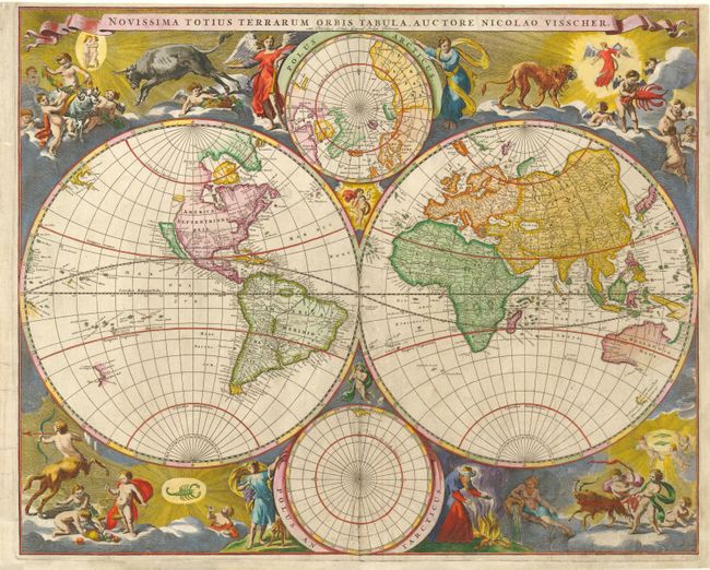
Subject: World

Period: 1695 (circa)

Publication:

Color: Hand Color

Size:
21.2 x 17.2 inches
53.8 x 43.7 cm
Download High Resolution Image
(or just click on image to launch the Zoom viewer)

This is an uncommon double hemisphere map featuring the island of California and a single, large Great Lake. Tucked between the cusps of the hemispheres are north and south polar spheres. The unique corner decorations feature superb engravings of the signs of the zodiac accompanied by cherubs and angels. The map is geographically based on the elder Visscher's map of 1658. The exact date of its first appearance is uncertain. But according to Shirley it was probably produced by Nicolas Visscher II after his father's death in 1679. This is the second state with cum Privilegio Ordin: General: Belgii Foederati printed below the title, probably from Van Keulen's 1695 atlas.

References: Shirley #486.

Condition: B

Visually very appealing with superb color and some minor flaws that have been expertly repaired. Minor surface soil and repairs of short tears along centerfold and one in lower left corner of map. Margins expertly extended at bottom and right side.

Estimate: $4,500 - $5,500

Sold for: $4,250

Closed on 3/2/2005

Archived