Catalog Archive
Auction 110, Lot 122
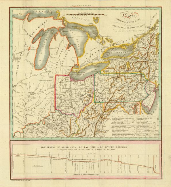
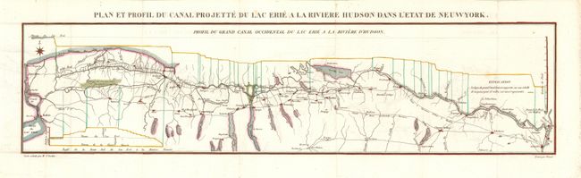
"[Lot of 2] Carte du Nord des Etats Unis et ou Grand Canal de Communication du Lac Erie a la Riviere d'Hudsons [with] Plan et Profil du Canal Projette du Lac Erie a la Riviere Hudson dans l'Etat de Neuwyork", Cordier, Louis Etienne Joseph
1 of 2
Subject: Eastern United States and Great Lakes
Period: 1820 (circa)
Publication: Histoire de la navigation Interieure
Color: Hand Color
Size:
See Description
Download High Resolution Image
(or just click on image to launch the Zoom viewer)
(or just click on image to launch the Zoom viewer)