Catalog Archive
Auction 110, Lot 116

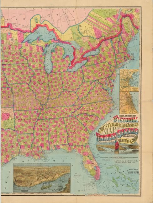
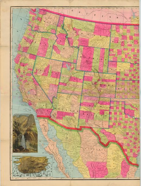
"Chas. Lubrecht's Pictorial County, Rail-Road & Distance Map of the United States and Part of the Dominion of Canada", Lubrecht, Charles

Subject: United States

Period: 1880 (dated)

Publication:

Color: Hand Color

Size:
56.4 x 36.5 inches
143.3 x 92.7 cm
Download High Resolution Image
(or just click on image to launch the Zoom viewer)

This is an exceedingly scarce, folding railroad map of the United States. The colorful map distinguishes counties and includes superb insets of Yosemite Falls, San Francisco, New Orleans, vicinity of New York City (with the Statue of Liberty), vicinity of Boston and vicinity of Chicago. The map itself shows railroad lines, projected railroads, railroad stations, roads, county seats, and forts. The map was designed to encourage German immigration to the western states. The coloring is very bright, to match the decidedly optimistic (expansionist) flavor of the map. Folds to 10 x 15" with brown paper adhered to one section. Missing slipcase. Published by Haasis and Lubrecht.

References: Phillips (M) p. 934; not listed in Modelski.

Condition: A

Professional reinforcement along folds with Japanese tissue.

Estimate: $1,500 - $2,000

Sold for: $1,300

Closed on 3/2/2005

Archived