Catalog Archive
Auction 109, Lot 688
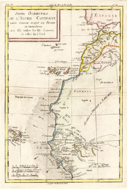
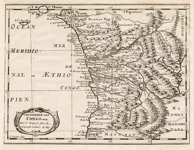
"[Lot of 2] Cote Occidentale d' Afrique [with] Partie Occidentale de l'Ancien Continent depius Lisbonne jusqua la Riviere de Sierra Leone…", Various
1 of 2
Subject: Africa - Western
Period: 1749-74 (circa)
Publication:
Color: Hand Color
Size:
See Description
Download High Resolution Image
(or just click on image to launch the Zoom viewer)
(or just click on image to launch the Zoom viewer)