Catalog Archive
Auction 109, Lot 359

"The Continuation of ye Road From London to Barstable in Com Devon", Ogilby, John
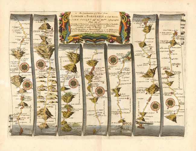
Subject: England

Period: 1675 (circa)

Publication: Britannia

Color: Hand Color

Size:
18 x 13 inches
45.7 x 33 cm
Download High Resolution Image
(or just click on image to launch the Zoom viewer)

John Ogilby's 'Britannia' was published between 1675 and 1698. It is a landmark in the mapping of England and Wales. Its unique format constituted the first national road-atlas of any country in Western Europe. It was composed of maps of seventy-three major roads and cross-roads, presented in a continuous strip-form, on a uniform scale of one inch to a mile. Each beautiful map includes wonderful detail of the countryside with each strip containing a large compass rose to indicate changes in direction.

Handsome road map in the pictorial style developed by Ogilby. The map begins near Bridgewater and proceeds in a easterly direction to Hatherley. Title cartouche in a strapwork and garland style.

References:

Condition: A+

Printed on good hand laid paper with nice wide margins of lovely color.

Estimate: $350 - $425

Sold for: $250

Closed on 12/1/2004

Archived