Catalog Archive
Auction 109, Lot 352

"Magnae Britanniae et Hiberniae Tabula", Hondius, Henricus
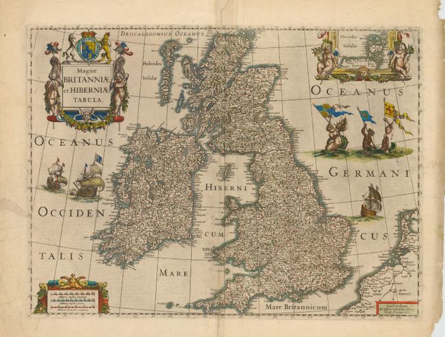
Subject: Britain

Period: 1631 (dated)

Publication: Gerardi Mercatoris Atlas sive Cosmographicae…

Color: Hand Color

Size:
20.4 x 15 inches
51.8 x 38.1 cm
Download High Resolution Image
(or just click on image to launch the Zoom viewer)

A boldly embellished map of the British Isles densely packed with information. The beautifully engraved map includes an inset of the Orkney Islands enclosed in a cartouche flanked by putti. The map is further adorned with sailing ships, mermaids displaying armorial flags and elaborate title and distance scale cartouches. This was one of several maps introduced by Hondius and Jansson in response to increased competition from their rival Willem Blaeu. This market pressure also resulted in the Hondius-Jansson atlas being issued in English, which was very unusual for Dutch publications of this period. Although dated 1631, this map only appeared in the Hondius-Jansson Atlas between 1633 and 1644. This example is from a scarce English edition.

References: Shirley (BI) #435.

Condition: B

Centerfold and 4.5" tear in lower left side, with old repairs.

Estimate: $1,100 - $1,300

Sold for: $850

Closed on 12/1/2004

Archived