Catalog Archive
Auction 109, Lot 197

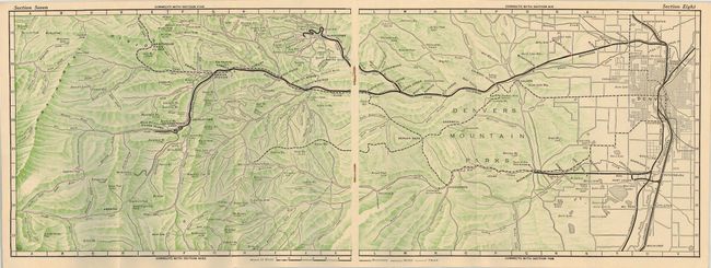
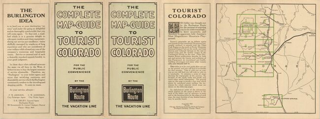
"The Complete Map-Guide to Tourist Colorado for the Public Convenience by the Burlington Route The Vacation Line", Railroad Companies, (Various)

Subject: Colorado - Railroad

Period: 1922 (published)

Publication:

Color: Printed Color

Size:
4 x 9 inches
10.2 x 22.9 cm
Download High Resolution Image
(or just click on image to launch the Zoom viewer)

Tall 8vo brochure folds out to a 9 x 12" format. Consists of 12 full-page maps in printed color, plus an index map and an index of names. The twelve maps show the railroad, country side and towns in great detail. The maps extend to include Estes Park, Granby, Frazer, Nederland, Central City, Webster, Como, South Platte, Morrison, Littleton, Denver, Pikes Peak, Colorado Springs, Boulder, Longmont, Loveland and Fort Collins. An uncommon item rarely found in this condition.

References:

Condition: A+

Short marginal tear in blank area of cover.

Estimate: $70 - $80

Sold for: $50

Closed on 12/1/2004

Archived