Catalog Archive
Auction 109, Lot 195

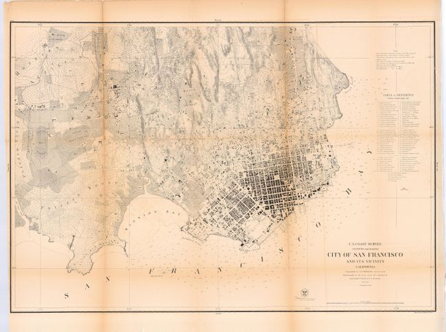
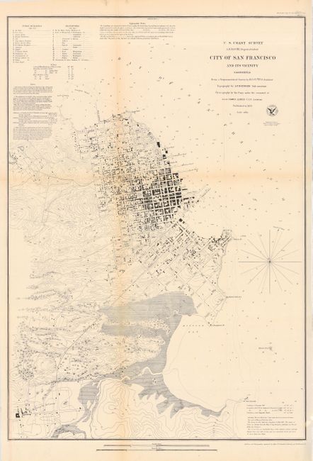
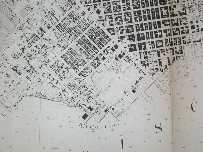
"[Lot of 2] City of San Francisco and its Vicinity California", U.S. Coast Survey

Subject: California - San Francisco

Period: 1853 &59 (dated)

Publication:

Color: Black & White

Size:
See Description
Download High Resolution Image
(or just click on image to launch the Zoom viewer)

A terrific set of city plans with the same title that makes an interesting study of the San Francisco's early growth. Both are fine plans with much detail including buildings, streets and roads, contour lines, etc. Tables list numerous public buildings, reservoirs, etc. The first map (17.7 x 25.5"), 1853, covers the region from North Point to Mission de Delores and to Point San Quentin. Extant buildings are shown in black along the streets in both San Francisco and Mission de Dolores, which are connected by a plank road. The second map (34.7 x 23.5"), 1859, is the larger and more highly detailed version drawn on a scale of 6" per mile, showing hundreds of individual houses and buildings. Table names and locates over 70 public buildings, numerous wharves and piers, etc. Map extends west to show the Union and Pioneers race courses, the Mission de Dolores and Rancho de San Miguel. A remarkable pair of city plans.

References:

Condition: B

Both issued folding and now backed with archival tissue. Both with toning along folds, the larger map more so.

Estimate: $450 - $550

Sold for: $250

Closed on 12/1/2004

Archived