Catalog Archive
Auction 109, Lot 166

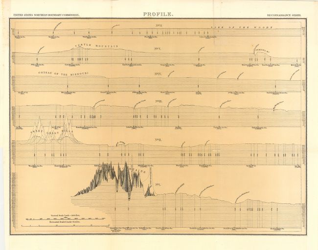
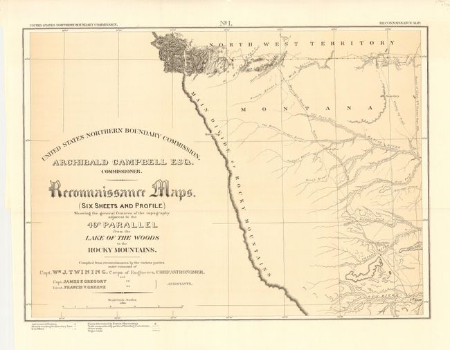
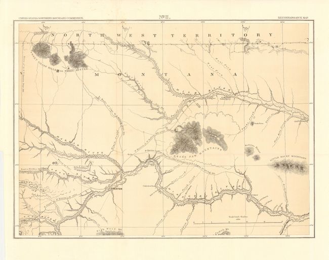
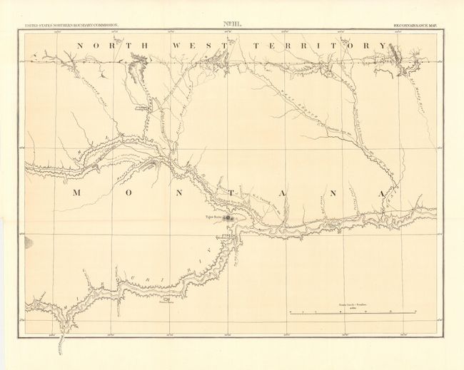
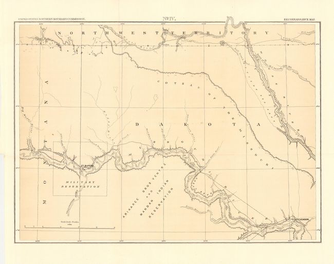
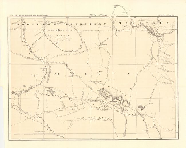
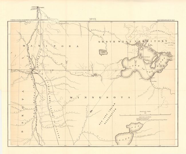
"Reconnaissance Maps (Six Sheets and Profile) Showing the general features of the topography adjacent to the 49th Parallel from the Lake of the Woods to the Rocky Mountains", U.S. Government

Subject: Central and Western United States

Period: 1878 (dated)

Publication: Senate Doc 41, 44th Cong., 2nd Sess.

Color: Printed Color

Size:
21 x 15.3 inches
53.3 x 38.9 cm
Download High Resolution Image
(or just click on image to launch the Zoom viewer)

Complete and matching set of all six maps, each sized as above, published by the United States Northern Boundary Commission. In 1872 Congress authorized a survey to determine and mark the U.S. - Canadian Boundary line along the 49th parallel. The survey accurately determined the boundary, and added very detailed topographical features in a 5-mile wide strip along the line. Excellent detail of rivers, towns and forts, springs, and topographical data. Locates the Blackfoot Indian Agency, Ft. Shaw, Ft. Benton, River Crow Indian Agency, Ft. Belknap, Old Fr. Browning, Ft. Turnay, Ft. Peck, Ft. Hawley, Ft. Buford, Ft. Berthold, Ft. Stevenson, Ft. Totten, Ft. Pembina, and Ft. Garry (Canada), plus numerous trading posts, Indian villages, and much more. The survey was completed in 1875 and published by Archibald Campbell and William Twining in 1878. Fine set of seven lithographed maps in remarkable condition.

References: Wheat (TMW) #1289.

Condition: A

Folding as issued. The profile sheet has two small fold intersection splits, else very good.

Estimate: $350 - $450

Unsold

Closed on 12/1/2004

Archived