Catalog Archive
Auction 109, Lot 154

"The United States of North America with the British Territories", Wyld, James
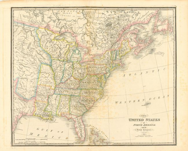
Subject: United States - Eastern

Period: 1838 (dated)

Publication: New General Atlas

Color: Hand Color

Size:
25 x 21 inches
63.5 x 53.3 cm
Download High Resolution Image
(or just click on image to launch the Zoom viewer)

This impressive large map shows the eastern part of the United States to just past the 100th meridian with a large Missouri Territory. The former Western Territory (still labeled) is now organized into Ohio, Indiana, Illinois and Northwest Territory. The old Spanish Cape Girardeau District, Lawrence District, and Arkansas Dist. are marked in the states of Missouri and Arkansas. The map provides excellent detail of Indian tribes, towns, settlements, roads, land grants, etc. There are several interesting notations concerning treaties including the treaty with Britain establishing the northern boundary in 1818, the treaty with Spain establishing the boundary with Texas in 1819, and various treaties with the Indians. Land grants include DeVallieres Grant above the White River and Cherokee Settlement in Western Arkansas, Colonel Simmes Donation Lands from the Commonwealth of Virginia and the Ohio Company, Army Lands, and Seven Ranges in Ohio, Lands Reserved for Virginia Troops and North Carolina Troops in western Kentucky and Tennessee, and Carver's Grant in Northwest Territory. This map was originated by William Faden in 1777 under the title "The British Colonies in North America." It went through a long series of revisions, each incorporating milestone developments in U.S. history. According to Tooley this is the twelfth issue, published by James Wyld, successor to Faden.

References: Tooley (Amer) p. 101, #80(l).

Condition: B

Some light offsetting and foxing throughout map. Tissue repair of a tear just right of centerfold 2" into map.

Estimate: $600 - $700

Sold for: $450

Closed on 12/1/2004

Archived