Catalog Archive
Auction 109, Lot 141

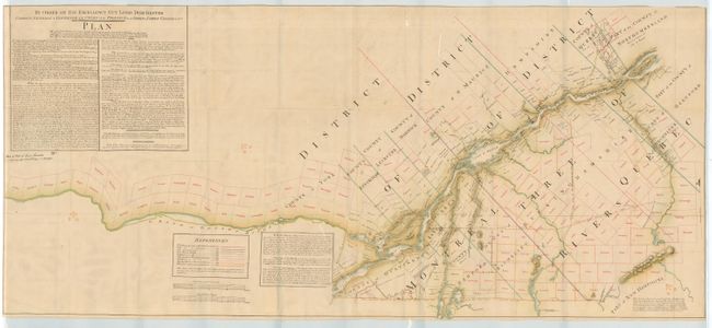
"By Order of His Excellency Guy Lord Dorchester Captain General & Governor in Chief of the Provinces of Upper & Lower Canada &c&c&c Plan…", Gale & Duberger

Subject: Canada

Period: 1880-1900 (circa)

Publication:

Color: Printed Color

Size:
57.5 x 26 inches
146.1 x 66 cm
Download High Resolution Image
(or just click on image to launch the Zoom viewer)

Later reprint of the famous manuscript map by Samuel Gale and John B. Duberger, originally published 1794-95. It currently resides in the McGill Library in Montreal. The map follows the River St. Lawrence from Island of Orleans and Quebec to Montreal and well west along the Ottawa River. Extends to the south along the River Richelieu to the northern portion of Lake Champlain. Scores of large plots are identified by owner's name. Terrific detail along waterways and rivers, and some topographical information. We find no record of this reproduction, but the printing techniques suggests it was printed 1880-1900.

References:

Condition: A

A few tears and fold splits, backed with linen. Still very good for a map of this size.

Estimate: $200 - $250

Sold for: $110

Closed on 12/1/2004

Archived