Catalog Archive
Auction 109, Lot 138
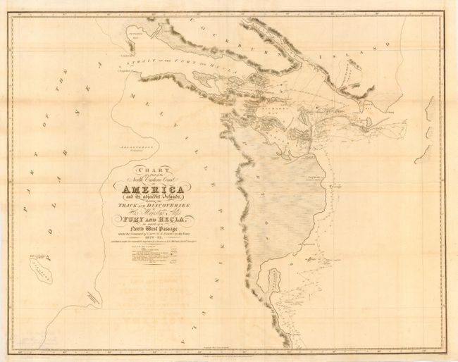
"Chart of a Part of the North Eastern Coast of America and its adjacent Islands, shewing the Track and Discoveries of His Majesty's Ships Fury and Hecla, in search of a North West Passage under the Command of Captn. W.E. Parry, in the years 1822-23", Murray, John
Subject: Canada
Period: 1824 (published)
Publication:
Color: Black & White
Size:
28.2 x 22 inches
71.6 x 55.9 cm
Download High Resolution Image
(or just click on image to launch the Zoom viewer)
(or just click on image to launch the Zoom viewer)