Catalog Archive
Auction 108, Lot 79

"America noviter delineata", Merian, Matthaus

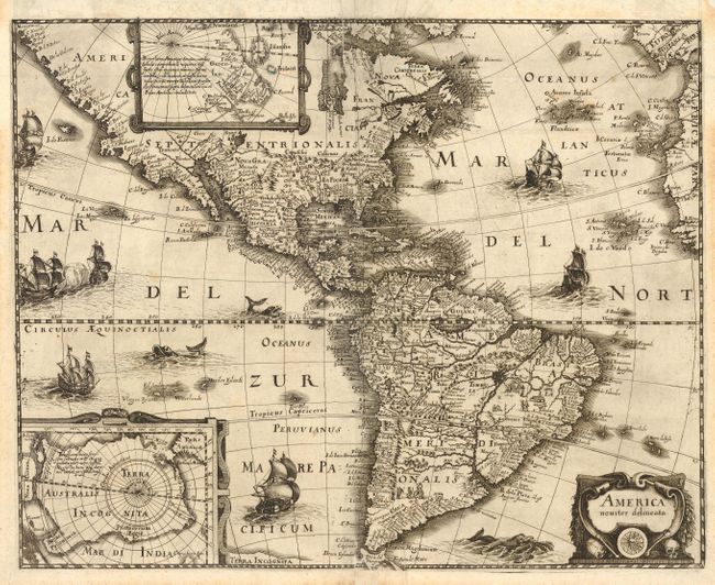
Subject: Western Hemisphere

Period: 1631 (circa)

Publication:

Color: Black & White

Size:
17.3 x 13.9 inches
43.9 x 35.3 cm
Download High Resolution Image
(or just click on image to launch the Zoom viewer)

This is the uncommon, larger, version of Merian's map of the Americas. Merian's bold engraving style copies the cartography of Jodocus Hondius' map of 1631. North America is depicted with a prominent Virginia and an odd New England coastline. The western coastline above California makes the continent too wide and there is only a hint of the Great Lakes. There is a large inland lake in equatorial South America. Insets of the Polar Regions are set in strapwork cartouches. The map is finely decorated with a title cartouche featuring human skulls and bones to represent cannibalism and the seas are teeming with ships, sea battles and fierce sea monsters.

References: Burden #235, Tooley (Amer) p. 299.

Condition: A

A very sharp early impression. Professionally backed with Japanese tissue.

Estimate: $2,200 - $2,400

Sold for: $2,000

Closed on 9/29/2004

Archived