Catalog Archive
Auction 108, Lot 530

"Palestinae Delineatio Ad Geographiae Canones Revocata", Briet, Philippe
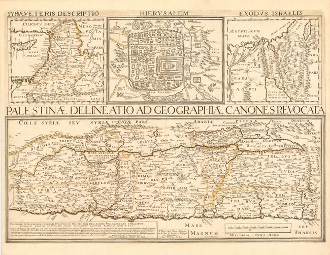
Subject: Holy Land

Period: 1641 (dated)

Publication:

Color: Hand Color

Size:
21.2 x 15.5 inches
53.8 x 39.4 cm
Download High Resolution Image
(or just click on image to launch the Zoom viewer)

A very scarce and interesting map of the Holy Land engraved by Henri le Roy and published by Pierre Mariette. The map is divided into the twelve tribes and filled with detail. Above the map are three smaller maps: a general map of the region from southern Turkey to the Nile delta, a plan of ancient Jerusalem, and a map of the Exodus.

References:

Condition: A

Original outline color, slightly faded, else fine.

Estimate: $300 - $400

Sold for: $475

Closed on 9/29/2004

Archived