Catalog Archive
Auction 108, Lot 321

"Milford-Haven", Collins, Capt. Greenvile
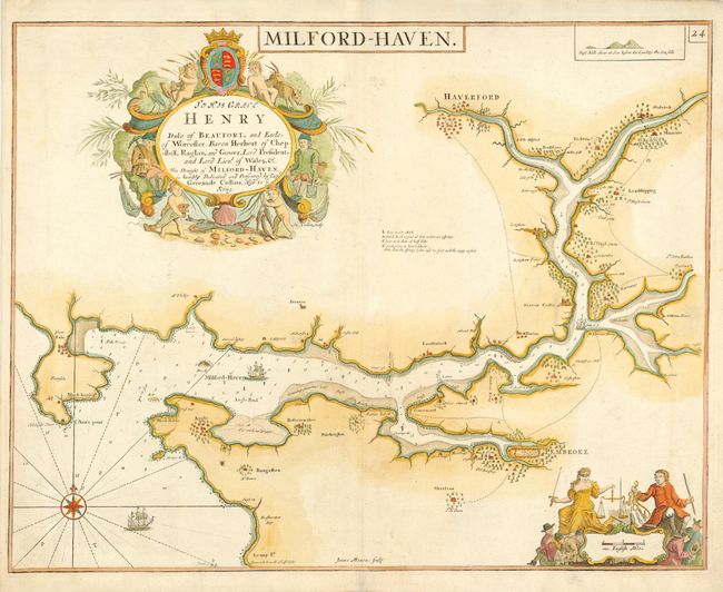
Subject: Wales

Period: 1697 (circa)

Publication: Great Britain's Coasting Pilot

Color: Hand Color

Size:
22.5 x 17.7 inches
57.2 x 45 cm
Download High Resolution Image
(or just click on image to launch the Zoom viewer)

Superb chart of Milford-Haven in southwestern Wales including the towns of Haverford and Pembroke. Finely decorated with a dedication cartouche "To His Grace Henry, Duke of Beaufort..." The map is further adorned with a beautiful scales of miles cartouche, a compass rose and sailing ships. Engraved by James Moxon. In 1681 Captain Greenville Collins was commissioned by the Admiralty to survey the sea coast of Great Britain. His charts were the most detail maps of the period and greatly improved the previous work of John Seller.

References:

Condition: A+

Estimate: $300 - $375

Sold for: $850

Closed on 9/29/2004

Archived