Catalog Archive
Auction 108, Lot 295

"Imperii Romano-Germanici in Suos Status et Circulos Divisi Tabula Generalis…", Homann, Johann Baptist

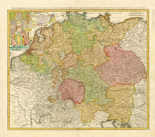
Subject: Central Europe

Period: 1730 (circa)

Publication:

Color: Hand Color

Size:
21.5 x 18.2 inches
54.6 x 46.2 cm
Download High Resolution Image
(or just click on image to launch the Zoom viewer)

Nice map covering much of Central Europe from eastern France to Poland and Hungary and into the Gulf of Venice. Filled with an amazing amount of information on the roads, villages, towns, watershed, forests, and more. Decorative cartouche with four angels and the emperor.

References:

Condition: B

Light impression in cartouche, else very good. Repaired tears in blank margins.

Estimate: $100 - $150

Sold for: $170

Closed on 9/29/2004

Archived