Catalog Archive
Auction 108, Lot 278
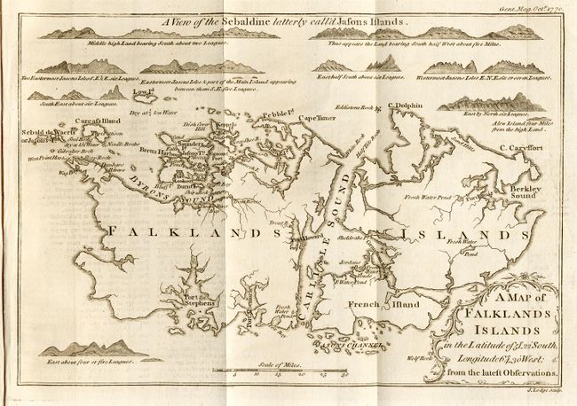
"A Map of Falklands Islands…", Lodge, John
1 of 2
Subject: Falkland Islands
Period: 1770 (published)
Publication: Gentleman's Magazine
Color: Black & White
Size:
9.5 x 6.5 inches
24.1 x 16.5 cm
Download High Resolution Image
(or just click on image to launch the Zoom viewer)
(or just click on image to launch the Zoom viewer)