Catalog Archive
Auction 108, Lot 222
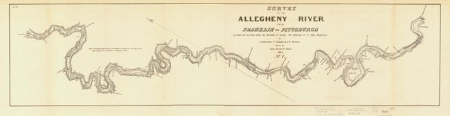
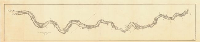
"Survey of the Allegheny River from Franklin to Pittsburgh No. 1 & No. 2", U.S. War Department
1 of 2
Subject: Pennsylvania and New York
Period: 1828 (dated)
Publication: HR Doc #343, 25th Cong. 2nd Sess.
Color: Black & White
Size:
69 x 7.4 inches
175.3 x 18.8 cm
Download High Resolution Image
(or just click on image to launch the Zoom viewer)
(or just click on image to launch the Zoom viewer)